Topic: History of Charts & Maps
Teacher Resources:
Printable PDF Version of this Lesson Plan
Downloadable PPT of Lesson (48mb)
Lesson 1 Handout – History of Charts & Maps (PDF)
Primary Goal : Introduce students to the history of charts and maps and how they are used today
Lesson Objectives :
· Learn why charts and maps were created
· Learn the evolution of charts and maps throughout history
· Describe the different types of charts and maps
· Understand the difference between charts and maps
· Know who uses charts and maps today
Lesson Outline :
I. Why do people use charts and maps?
a. Determine where they are
b. Determine where they need to go
c. Determine the best way to get there
II. How long have maps been around?
a. Maps have been around for thousands of years (Babylonian tablets)
b. Used as tools to help humans understand and navigate their way through the world
c. Using the information contained, you can determine the fastest (and easiest) way between two locations
d. Also used to determine the geography (intro: topographic map)
i. Why is this important? (Alexander the Great, Hannibal)
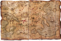
III. What are charts?
a. “Road Maps” for people traveling on the water
b. Nautical charts describe the maritime area
i. Water depths (soundings)
ii. Aids to navigationiii. Surrounding land area
IV. History of Charts
a. Jefferson ordered the first survey of the US coast in 1807
b. Created the Office of Coast Survey (OCS)
c. Show a picture of an original chart (NOAA link to historical chart search below in “Supplemental Resources”)
V. Who uses charts and maps today? (ask students)
a. Ex. Shipping companies, architects, land surveyors, Amazon, YOU, etc.
b. How are they used?
c. Show PBS video
Supplemental Resources :
Exercises/Activities :
Have students break up into groups and describe how they have personally used a map or chart. Have 1 person from each group share.
![]()